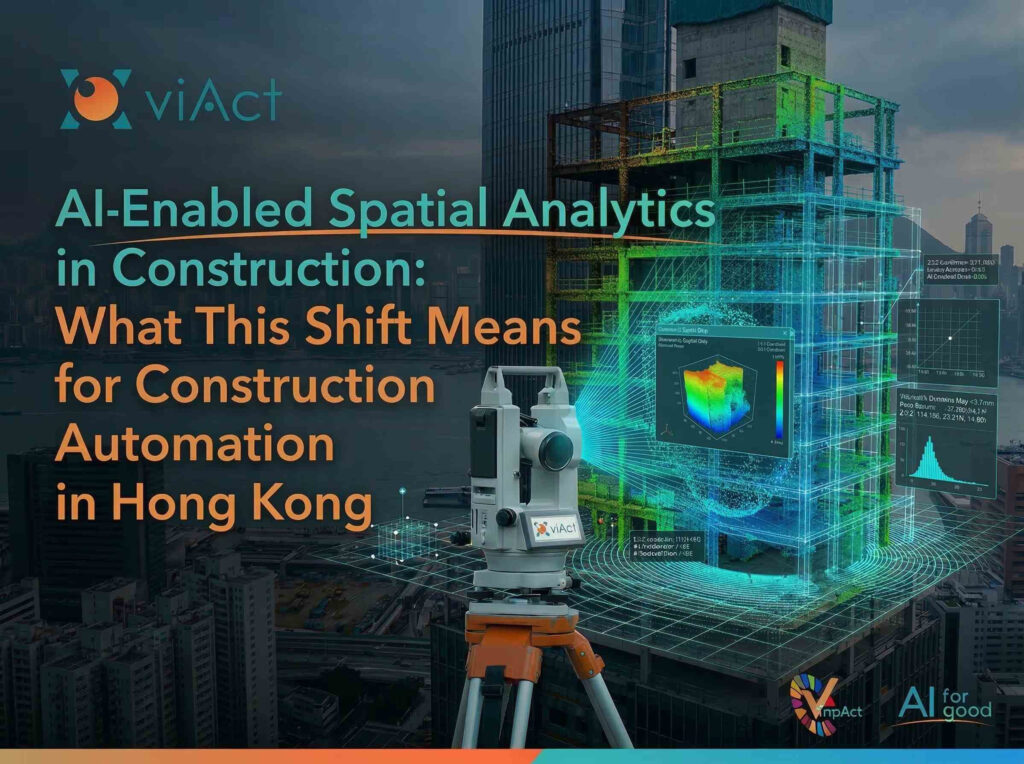

Hong Kong infrastructure has entered a new phase of digitally supervised construction, where Artificial Intelligence (AI) and spatial sensing technologies are transforming how complex projects are monitored. AI-enabled spatial analytics, LiDAR scanning, and automated progress tracking are being implemented in large public work projects to enhance quality oversight, safety visibility and overall transparency on construction sites. This shift is indicative of an industry-wide recognition that traditional supervisory methods have difficulty keeping up with the size, density and complexity of contemporary infrastructure development.
Recent development show that this transformation is happening at a very rapid pace. The Hong Kong Development Bureau (DEVB) is actively promoting a new form of digital supervision technology that will allow engineers and construction project regulators in the city to use AI analysis and LiDAR-based spatial mapping to conduct remote monitoring of construction activities and progress across major construction projects. The government announced that through the use of this technology, engineers and regulators will be able to remotely capture accurate site conditions as well as review construction progress, which will result in reduced reliance on physical inspections and will improve accountability for all parties involved in a construction project.
In parallel, there are also ongoing discussions within the infrastructure sector about utilizing AI to transform construction processes. An article in the South China Morning Post illustrates how AI tools are already impacting the creation of construction schedules, to confirm construction progress, and to perform risk assessments; demonstrating an increasing trend toward construction management being driven by real-time data. As projects continue to increase in scope, and schedules get progressively shorter, having the capability to continuously monitor jobsite conditions using digital technologies has become a significant competitive edge.
This blog aims at exploring what this shift looks like in practice, from the mechanics of LiDAR-based spatial capture to the operational and regulatory advantages now emerging across Hong Kong’s infrastructure sector.
Examining this shift will give us insight into how the introduction of technologies such as spatial analytics and LiDAR-based monitoring are changing the way the construction industry will be automated in the long run, not only in Hong Kong but throughout all infrastructure sectors globally.
The nature of construction sites is constantly evolving. Every day, work zones are relocated, equipment traverses the entire construction site, and construction materials are delivered and placed on a daily basis. Conventional monitoring strategies like manual inspections or static reports, typically only provide a limited view into actual site activities. As a result, it is challenging for construction project managers to have a sustained awareness of the evolving conditions of a construction site. AI-enabled spatial analytics for construction has started to alter the manner in which construction infrastructure is monitored and managed.
Key Capabilities of AI-Enabled Spatial Analytics in Construction
-
Continuous understanding of site environments: When spatial data is integrated with digital project models, construction teams can compare planned progress against real-world conditions, helping identify schedule deviations, workflow inefficiencies, or material placement issues earlier.
-
Predictive Risk Scoring and Schedule Forecasting: By continuously mapping physical progress against BIM models or project schedules, AI can flag emerging delays or resource conflicts before they cascade, shifting teams from reactive course-correction to proactive project control.
-
Improved risk monitoring across dynamic worksites: Construction sites typically involve a number of overlapping tasks, with multiple contractors working above each other at the same time. With AI-enabled spatial analytics, site risk monitoring can be enhanced through the analysis of changes in surroundings and identification of patterns of unusual operations that may indicate potential emerging hazards.
-
Remote situational awareness for project stakeholders: Centralized dashboards make spatial data accessible to all the stakeholders, like engineers, project managers, and regulators, enabling them to review site conditions remotely and maintain multi-project oversight.
-
Data-driven construction management: Through continual analysis of how physical environments develop, spatial analytics allows teams to move from reactive reporting to data-informed project management. This allows them to react more quickly to operational changes.

Thus, AI-based spatial analytics allows data collected from the construction environment through AI system and converts it to actionable information to assist construction teams to determine not only what is happening on site, but also how the entire construction environment is evolving in real-time.
How 4D LiDAR Data Enables Real-Time Spatial Data Analytics
The increasing complexity of large construction projects means it is harder than ever to monitor sites through traditional visual means. Although traditional cameras provide images of jobsites, they do not always provide enough depth or spatial perspective to be able to see how the jobsite evolves over time. Emerging technologies like 4D LiDAR construction monitoring and 3D scanning construction sites provide more accurate spatial data about the jobsite, so that there can be a clearer understanding of what has taken place on the jobsite and as it continues to evolve.
How LiDAR-Based Spatial Monitoring Works
-
High-density spatial data capture through LiDAR point clouds: Lidar sensors use lasers to find distance between the scanner and their environment, creating a large database of LiDAR point cloud construction data, with millions of spatial data points that create digital representations of a construction environment.
-
3D scanning of construction sites for precise environmental mapping: Project teams can obtain 3D scans of construction sites, digitally map site layouts, including structural features, equipment locations on-site, and evolving work zones. This allows project teams to maintain an updated spatial record of their ongoing project progress.
-
4D monitoring to track construction progress over time: When project teams take repeated scans of a construction site, they accumulate a 4D dataset by adding the measurements taken each week and adding them to previous weeks’ measurements. This dataset allows project teams to see how construction sites evolve throughout each phase of a project.
-
Real-time spatial data analytics for construction oversight: Using advanced AI systems, spatial databases can be analyzed to identify changes in structural features, deviations from project plans, and monitor how construction zones are progressing relative to one another. This allows construction project managers to use real-time data analytics to gain greater visibility into the ongoing activities at their construction sites.
-
Improved transparency and verification across infrastructure projects: Engineers, contractors, and regulators can use spatial monitoring technologies to monitor the construction progress and compare the condition of a site against the original design model and schedule. Industry conversations surrounding 4D LiDAR have indicated that using technology can significantly improve construction progress verification and reduce reliance on manual reporting.
These capabilities allow infrastructure projects to be monitored differently, as the use of AI-powered spatial intelligence and LiDAR scanning helps maintain a real-time view of how a construction project progresses. Thus, the monitoring process no longer relies on periodic inspections or historical reports.
From Inspections to Intelligence: The Evolution of Construction Monitoring
For decades, site engineers and supervisors physically walked around the jobsite inspecting work and reporting on instances of worker safety. While these inspections provided positive oversight, they would only provide a very limited insights of site conditions and performance, rather than a full understanding of how the project is progressing.
As construction projects became larger and more complex, there is a need to evolve methods used to monitor them. In response to this, more CCTV cameras were used to provide increased visibility over larger jobsites. Although, this allowed for greater visual coverage, it still required individuals to interpret what they saw and lacked the type of spatial information needed for effective analysis of structural progress and operational changes.
However today, AI spatial analytics and LiDAR sensing technologies are changing how the construction industry monitors sites. Instead of only recording construction sites, these advanced monitoring systems can also interpret them.
The Three Phases of Construction Monitoring Evolution
|
Manual walkthroughs and reports by site supervisors |
Limited frequency of inspections, subjective observations, delayed reporting |
Basic oversight of safety and progress |
|
|
CCTV and visual surveillance systems |
Heavy reliance on manual review, limited spatial understanding |
||
|
AI-enabled spatial analytics combined with LiDAR and 3D scanning |
Requires digital infrastructure and spatial sensing technology |
Continuous spatial analysis, automated progress tracking, enhanced risk monitoring |
What This Evolution Means for Construction Operations
-
Audit-ready documentation for regulatory compliance: Each spatial scan generates a timestamped, objective record of site conditions. This creates a verifiable evidence trail that regulators and project owners can reference during audits, dispute resolution, or post-project review, replacing subjective manual reports with a data-backed history of every phase.
-
Objective analysis of construction environments: AI systems are able to accurately assess both spatial and operational site data automatically and consistently, resulting in less reliance upon subjective human judgment in assessing jobsite conditions and overall construction project activity.
-
Better coordination across project stakeholders: Digital monitoring platforms allow for real-time, simultaneous access to jobsite data by engineers, contractors and project managers within the same construction project.
-
Improved operational transparency: Digitally monitoring construction jobsites allows for more accurate documentation of site conditions and overall progress of the jobsite.
This transformation represents significant milestones for the construction industry. Monitoring of construction projects is no longer limited strictly to observation of site activities. It has transitioned into an ongoing system capable of evaluating how entire jobsite changes and evolves over time, thereby supporting improved decision-making related to large and complex infrastructure projects.
Why Real-Time Spatial Data Analytics is Shaping the Future of Infrastructure Projects in Hong Kong?
Hong Kong infrastructure is one of the most complicated environments of urban construction in the world due to its high-density city layout, significant investment in public infrastructure, and governmental oversight of all construction projects. Therefore, construction projects in the region are required to operate with a high level of operational transparency and efficiency. The use of technologies for the real-time analysis of spatial data with construction systems is, therefore, becoming more important for the management of ongoing construction progress and coordinating activities on complex worksites.
Why Spatial Analytics Is Becoming Critical for Hong Kong Infrastructure Projects
-
Managing construction complexity in dense urban environments: Construction projects in HK are typically built upon tightly constrained urban areas. Real-time spatial analytics enables project teams to understand how equipment, materials and work zones interact with each other. This allows project teams to enhance their coordination among multiple contractors, resulting in improved project delivery outcomes when working in the limited urban spaces.
-
Improving progress verification across large public works programs: Most construction projects have multiple phases and stakeholders. Spatial analytics technologies allow project teams to compare the captured site conditions against the design models, enabling the project teams to quickly verify construction progress and detect deviations from the construction schedule and design specifications earlier.
-
Supporting remote supervision and regulatory transparency: Digital monitoring systems allow engineers, consultants and regulators to remotely review and monitor the site conditions after they have been compiled onto a central data repository. Central repositories reduce the need for ongoing on-site inspections while still providing adequate levels of oversight for the various projects.
-
Strengthening data-driven project management: By continuously capturing spatial data about construction sites, project managers are able to base their decisions on real-time operational information rather than historical operational information. This allows project teams to be more able to respond quickly to related workflow changes, challenges due to material logistics, and operational bottlenecks.
-
Enabling more proactive construction risk management: Continuous spatial monitoring enables early identification of site anomalies or unexpected operational behaviours, leading to improved safety incident prevention through the identification of emerging issues prior to their escalation into greater operational risks.
As the construction industry in Hong Kong changes quickly, the move towards more digital and data-driven projects is getting more momentum because of these technologies. With the continued maturation of spatial analytics technologies, their use will only become more vital for better planning of smarter infrastructure, improved coordination among contractors and more efficient management of projects.
The Emerging Role of Spatial Intelligence Platforms: A Look at viAct’s viLid
Monitoring technologies in the construction industry are evolving rapidly, and as these technologies evolve, the way they are used also changes. In this case, as new technologies for monitoring construction projects evolve, more and more construction projects are transitioning from using individual monitoring tools to using a single set of integrated spatial intelligence platforms. By combining spatial sensing technologies, AI-powered analytics, and digital project data, companies can now create a much more detailed picture of how the construction environment will change over time.
Spatial intelligence systems allow project teams to see how different aspects of the jobsite, like work zones, materials, and equipment, interact with one another and function in this complex construction environment, rather than just relying on cameras, inspections, and/or reports (that are out of date) by providing a complete picture of each aspect’s position relative to everything else.
viAct’s “viLid” is one such example. Through advanced analytics and spatial sensing technologies, viLid helps infrastructure teams interpret construction environments more easily. By analyzing the spatial data collected from work sites, it allows project stakeholders to maintain a continually updated picture of site conditions and construction progress. This is especially valuable for large scale infrastructure programs where the existence of multiple contractors in several different changing work zones can create a difficult environment to do so.
Tools such as viLid is also supporting centralized project supervision, as spatial insights across all construction zones can now be included in a Central Monitoring System (CMS) for engineers, consultants and project managers to see conditions of the site through one digital platform. This results in better coordination between the stakeholders and allows for the project teams to track any operational changes made during the project without having to fully rely on frequent site visits.
What tools like viLid represent is not simply a technology upgrade, but a fundamental shift in how accountability is structured across large infrastructure programmes. As Hong Kong continues to scale its public workers investment, the ability to generate verifiable, real-time spatial records will become as foundational to project governance as contracts and schedules. For construction teams, the question is no longer whether to adopt spatial intelligence, but how quickly they can embed it into their planning, supervision, and delivery.
Conclusion: Key Takeaways
Spatial sensing technology and AI are changing both the way construction projects are both managed and delivered. As infrastructure programs become more complex, traditional site inspections are increasingly supported by technologies that continuously interpret construction environments. In Hong Kong’s dense urban landscape, AI-enabled spatial analytics is improving transparency, coordination, and project accountability. By transforming spatial site data into actionable insights, construction teams can move toward more connected and data-driven supervision models. Tools such as viAct’s viLid highlight how spatial intelligence may support the next phase of construction automation and infrastructure governance.
-
AI-enabled spatial analytics is revolutionizing how construction sites are monitored, by enabling continuous analysis of changing site conditions.
-
Construction teams can use technologies such as LiDAR and 3D site scanning to generate new detailed spatial datasets that provide greater visibility into construction progress.
-
The move away from manual inspections to spatial intelligence systems represents a significant evolution in construction monitoring practices.
-
In Hong Kong’s highly regulated and densely populated infrastructure environment, spatial analytics technologies are helping to improve project coordination, transparency, and remote project oversight.
-
Integrated spatial intelligence platforms enable construction teams to convert raw site data into actionable insights so that they can better manage their projects.
-
As spatial data technologies continue to develop, it is anticipated that they will facilitate even greater automation and data-driven approaches to construction oversight and infrastructure delivery.
1. What is AI-enabled spatial analytics in construction?
Spatial analytics powered by Artificial Intelligence (AI) provide insight into the construction field by using AI to analyze spatial information obtained from construction surroundings. These spatial datasets can be collected via LiDAR scanning technology, and 3D site mapping, which provide AI systems with rich, high-resolution datasets that allow interpretation of the evolution of a construction site over an extended period of time. This enables construction project teams to assess the current status of a project, locate any deviations from expected conditions, and gain further visibility into how infrastructure projects are progressing in real-time.
2. How does viAct LiDAR technology help monitor construction sites?
LiDAR technology captures detailed spatial measurements by emitting laser pulses that calculate the distance between the sensor and surrounding objects. These measurements generate dense spatial datasets that digitally represent construction environments. When collected regularly, these scans allow engineers and project managers to observe structural changes, track progress across different work zones, and maintain a more accurate understanding of site development.
3. What is the role of 4D LiDAR data in construction monitoring?
The 4D LiDAR data is used by construction teams to monitor project progress across time as well as through three-dimensional measurements of the jobsite. Construction teams can make comparisons between the actual construction progress at any moment to the planned schedule and detect variations earlier, therefore enhancing project coordination and management capabilities.
4. How can spatial intelligence platforms, like viAct, support construction automation?
Construction Management Platforms like viAct integrate AI with spatial sensing technologies and project data to provide a constantly updated understanding of the construction environment. By using these technologies to monitor how conditions on the site have changed over time, and comparing those changes to project models/schedules, it can provide teams with insights on automated progress verification, anomaly detection, and data-driven decision, helping them move toward more automated and intelligent construction supervision.
5. Which types of infrastructure projects benefit most from spatial analytics technologies like viAct?
The benefits of spatial analysis are maximized in very large and complicated projects where there are multiple contractors working together. Examples of projects where spatial analysis could provide value are: transportation-related projects such as bridges and tunnels, rail systems, airports, and public housing developments consisting of a large number of buildings. Under these conditions, keeping track of changing site conditions can affect the ability to coordinate and deliver a project on time.
– viAct is the leading Impact AI company enhancing safety in high-risk industries for a sustainable future.