Skip to content
Mapping technology giant Esri is integrating Microsoft Azure OpenAI service into its flagship ArcGIS line of geographic information systems products, the company announced at its annual user conference in San Diego July 14.
The collaboration allows Esri’s GIS professional users to use artificial intelligence assistants to simplify work with geospatial data, maps and analytics. The AI’s natural language interactions will also allow users to better understand complex spatial problems and even generate code to solve them.
“In engineering, applying the concepts of geographic knowledge to making the world a better place is more powerful than ever,” Esri CEO Jack Dangermond said in his opening plenary speech July 14.
“Agentic AI is a new age where your work is going to move faster and faster. The world doesn’t just need this AI infrastructure, it needs your work transforming how we understand, collaborate and solve problems.”
Esri also announced that ArcGIS will allow importing Gaussian splats as a new layer type later this year. Gaussian splatting is a volumetric rendering technique that can directly render volume data using a series of ellipsoid shapes, without first converting it to a data set of surfaces or lines.
Bringing Gaussian splats into a program like ArGIS Pro—which already has geo-referenced and support data such as real-time height shifts—allows them to render faster than “heavier” data sets such as point clouds or meshes in global and local scenes, and can be integrated more quickly into other data.
Conference attendees were walked through this new process by Esri executives Thomas Zwölfer and Konstantin Hoppe from the company’s research and development center in Stuttgart, Germany. Zwolfer and Hoppe showed drone imagery captured from the construction site of Stuttgart’s new Main Station, a $40-billion project that involves converting the existing terminus station into a completely underground rail hub.
Zwolfer showed the drone data being brought in as a Gaussian splat ready to use. The pair also showed new AI tools detecting and mapping 3D features from these maps including steel beams, wood panels and other materials, all taken from drones or satellite imagery of the site.
“Capturing fine details gets us ready for autonomous asset monitoring,” Hoppe said.
As part of the expanded Microsoft collaboration, Esri announced that ArcGIS for Microsoft Teams now has a declarative agent for Microsoft 365 Copilot, which provides AI-driven search and discovery of authoritative maps, apps and location data directly within Microsoft Teams, Microsoft Outlook and Microsoft 365 portals.
One of the new AI assistants from the CoPilot integration was shown creating code for a search operation for a civil construction project based on a conversation the operator had with the CoPilot chatbot in a chat panel. Geo-detection AI tools were shown detecting potholes for transportation department maintenance based on drone flights and photos in its database, a process that could take humans in trucks several days to identify and report.
“By democratizing geospatial understanding, we are removing barriers and empowering users to unlock the full potential of location intelligence,” said Jay Theodore, Esri chief technology officer for AI and enterprise technologies. “This collaboration represents a major milestone in our journey to make spatial analysis more accessible and impactful for organizations of all sizes,”
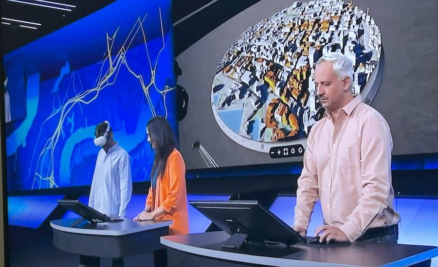
On the BIM front, Esri introduced an extended reality viewer offering users one XR environment for all of the ArcGIS products. Two people were shown exploring all of the buildings in Wellington, New Zealand, over a tabletop in the viewer’s city view. The immersive environment allowed them to work together on planning decisions such as site selection with information such as fault lines turned on and off from an ArcGIS basemap. When it was ready, a BIM model of what was built was brought directly into the XR viewer.
“Our world needs a new approach that integrates our collective knowledge and creates better understanding,” Dangermond told attendees.